Data parsing
Public opendata portals, OpenStreetMap, client data
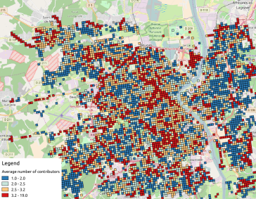
Should you have your own geodata, or should you get public open data, you may benefit from mixing a various range of data.
Administrative data, socio-economical data, transportation data, and so on...there is no limit!
Data cleaning
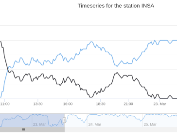
Feature engineering, high-resolution image tiling, timeseries sampling.
Are your input data clean?
Raw data are generally not ready for production purpose, some requalifications are needed to let you exploit their full potential.
Data treatments
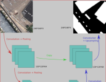
Supervised and unsupervised machine learning, routing algorithms
Regarding machine learning, you have a lot of labelled data ? You may train a supervised algorithm!
Even without AI, algorithms may be used to compute routes, filter images, analyze timeseries, ...
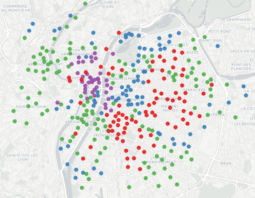
Data visualization
Design web applications or QGIS plugins.
Let us design a web dashboard that fits your need! In case you need to integrate your dataviz into QGIS framework, a lot of possibilities exist too.
In any case, we can imagine solutions that are closed to your database.